
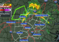
Three more tornadoes were formed by the line of severe storms that rumbled across Michigan for hours Thursday night, according to National Weather Service survey teams. This brings the number of confirmed twisters from that night’s extreme weather to nine.
The NWS team in Grand Rapids reported that two of the most recent verified tornadoes happened in Allegan County. Another started in Kent County and spread to Ionia County.

They caused damage to a campground, roofs on homes, and uprooted trees. There were no injuries recorded. All three of the most recent tornadoes were rated EF-1, which is among the weakest twisters on the Fujita intensity scale.
After a large line of storms swept through with destructive winds late Thursday and into the overnight hours, NWS survey teams from the Grand Rapids and Detroit offices headed out Friday to assess some of the most severely damaged regions. This included areas with felled trees, fallen trees on houses, and power outages. Saturday saw the continuation of survey work and assessments.
Here are the specifics of the most recent three tornadoes:
An EF-1 tornado struck Allegan County near Martin. This tornado had estimated peak speeds of 95 mph and stayed on the ground for slightly over 8 miles. It touched down around 10:41 p.m. on Thursday and lasted eight minutes.
According to the National Weather Service, the tornado formed near the intersection of 114th Avenue and N16th Street, where a power pole was thrown over. The forming tornado crossed Schnable Lake and severely damaged the campground on the lake’s north shore, causing several flipped trailers and wrecked roofs due to falling trees. The tornado continued to do structural damage as it passed 115th Avenue. The most serious damage occurred near and east of the intersection of 116th Avenue and U.S. 131, and it extended east into downtown Martin. The tornado gradually weakened as it proceeded east of Martin, eventually dissipating at the Allegan-Barry county line (Boysen Road).
An EF-1 tornado occurred near the Sandy Pines campsite, located on the south side of Dorr in Allegan County: This tornado produced peak speeds of 90 mph and remained on the ground for 5 miles. It landed around 10:28 p.m. Thursday and lasted approximately 5 minutes.
According to the NWS, the tornado formed near Sandy Pines campground and intensified around the intersection of 138th Avenue and 24th Street. The primary damage consisted of multiple trees being uprooted and snapped. Some of the most severe damage and winds occurred at Hilltop View Drive and 21st Street.
The EF-1 tornado traveled from Kent County to Ionia County, had a wind speed of approximately 90 mph, and spanned over 14 miles across both counties. It made landfall about 10:51 p.m. on Thursday and lasted till 11:08 p.m.
According to the NWS, the tornado primarily damaged trees along its 14.5-mile path. The tornado developed approximately east of the Thornapple River, northeast of Caledonia. It traveled northeast, causing the most damage around Campbell Lake, where residences had roof damage. The train continued northeast, crossing I-96 around Hastings Road and ending just south of Saranac.”