
River levels in western Ohio may increase over the flood threshold this week as heavy rain and thunderstorms begin on Monday.
According to the National Weather Service Ohio River Forecast Center, the region may receive several inches of rain through Friday, May 23, with the largest amounts forecast in western counties such as Allen, Auglaize, and Darke. By midweek, rivers in these places may have reached or exceeded the minor flood level, with localized flooding occurring in low-lying areas.

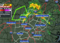
A 5-day precipitation chart reveals that rainfall totals of 2 to 4 inches were prevalent across the Ohio River Basin, particularly in southern Ohio around Dayton and along the Scioto and Great Miami rivers. Flood-prone communities, such as Findlay and Lima, should actively monitor developments, especially since soils are already wet from recent showers.
Drivers are advised to avoid flooded highways and to monitor river gauges along U.S. Route 33, I-75, and smaller county roads, which are generally flooded first. Residents living near flood-prone creeks or rivers should begin preparing immediately by storing valuables and establishing a backup power source.
Flood alerts may be issued with short notice. The threat remains until next weekend, when further storms are anticipated.