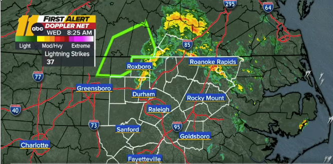
Expect a stormy and potentially hazardous Wednesday morning commute as strong to severe weather moves in overnight.
Isolated severe thunderstorms are possible between 3 a.m. and 9 a.m. The main threats include damaging straight-line winds and large hail, with a slight chance of an isolated tornado.

Timeline
Storms will begin to form late Tuesday night and continue into the Wednesday morning rush hour. The front is expected to push through by later in the day, but a few more storms could pop up in the afternoon as temperatures climb into the upper 80s.
The highest risk for severe weather lies east of the Triangle, where locally heavy rainfall is possible. Most areas will receive about 0.25 inches of rain, though some spots could see more.
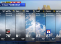
Looking Ahead
Humidity levels will fall on Thursday, bringing more comfortable weather with highs in the upper 70s to low 80s and lows in the mid to upper 50s.
Mild and pleasant conditions are expected to stick around through the holiday weekend. Temperatures will trend below the seasonal average of 80 degrees, with daytime highs in the mid to upper 70s and nighttime lows in the 50s.
Rain chances may increase again late in the weekend as a weak disturbance moves across the Southeast.