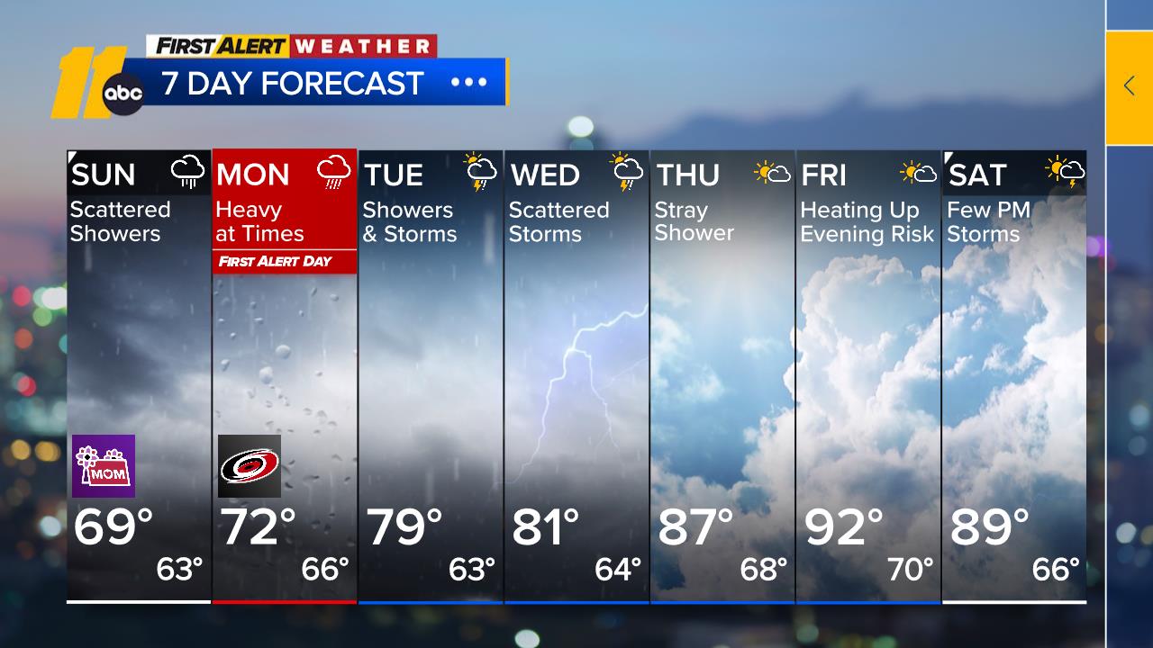
Cloudy skies have spread across much of the state this morning, thanks to an upper low over the lower Mississippi Valley. Showers and thunderstorms from Georgia and South Carolina are expected to move into North Carolina later this morning.
The heaviest thunderstorms are expected to stay south of the Triangle today, but areas from the Triangle and northward may experience some drying by the evening. However, more moisture will arrive later tonight as the upper flow begins to move northeast.


These showers will be helpful along the coast, where there is currently a moderate drought. However, any downpours could cause ponding on roads and highways, as well as flooding in low-lying areas or regions with poor drainage if multiple rounds of storms occur.
Heavy rain could also lead to rises in streams and rivers across the region.
By Tuesday, deep moisture will move in during the afternoon, and the heaviest rain is expected for the Triangle early in the morning. A few leftover showers and thunderstorms may linger through the evening. With moderate instability and shear, locally gusty thunderstorms could also develop, especially along the coast. From today through Tuesday evening, expect rain totals of 1-3 inches, with higher amounts in areas with the heaviest thunderstorms.
Although the heaviest rain should end by Wednesday, additional rounds of showers and thunderstorms are expected as the low opens into an upper trough but remains over the region. Once the trough shifts off the coast by Thursday, any showers should be limited to the eastern parts of the state, and we can expect a mostly dry day.
This dry spell will be short-lived, however, as attention turns to an approaching cold front next weekend. While there is some uncertainty about the timing of the front, Friday should remain dry and very warm before rain chances return for the weekend.